yes, thank you for sating my curiosity there. and I promise that's all it is. not trying to wind anyone up ten years too late.
i remember there being two schools of thought about the code. some thought there were three coordinates forming a triangle with the apex near whitekirk, which contains another triangle in the wood linked by the paths east of binningwood which I found so compelling (accidentally left the three points plotted on my first google map link above, but also stuck it in my sig below for easy access). others seemed to be looking at two other places, earlyburn being one. just to be a completist nerd, here are the two areas I was interested in on one map.
https://www.google.com/maps/dir/55.7292 ... 1111?hl=en
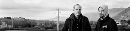
while I'm summing it up, here is the interview which is the other half of what re-ignited my curiosity in the area. there's a great view of the bass rock taken on a nice clear day on street view now.
http://bocpages.org/wiki/Protect_and_Su ... terview%29
hope this ins't too intrusive to anyone up there, but then again the interview has been up since Campfire. just thought it was an interesting coincidence of time and space between that and whatever happened the next summer.



 ∴
∴